As remote as it gets! An island archipelago 100 miles from the Scottish mainland and 40-50 miles further out into the Atlantic than the Outer Hebrides.
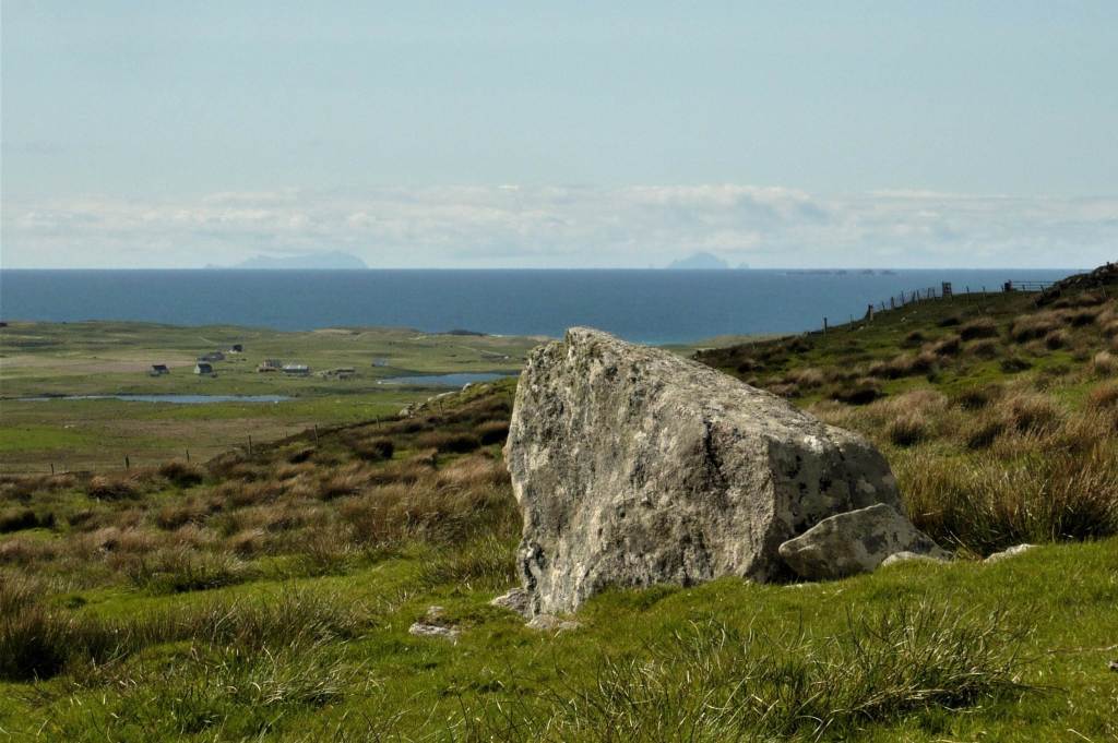
On a clear day St. Kilda can be seen from the Outer Hebrides and the closest place to it is North Uist, where there’s a Kilda viewing point. The photo below was taken beside a Neolithic cairn near the viewing point. Two islands can be seen faintly on the horizon and the one on the left is Hirta and the the one on the right with the very distinctive shape is Boreray.
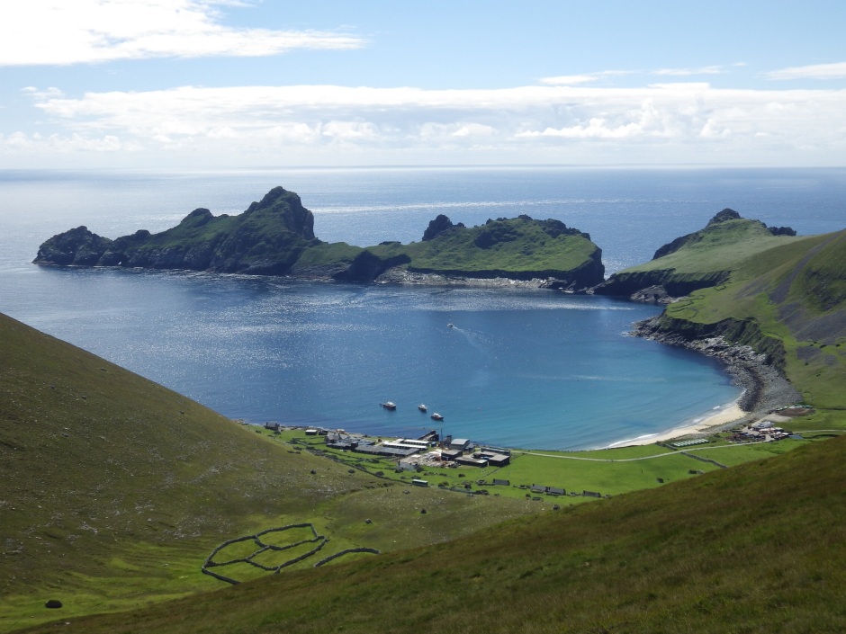
The archipelago is volcanic in origin and is made up of four main islands –Hirta is the main one, and the others are Soay, Boreray and Dun. The islands are the most dramatic you’ll find anywhere in the British Isles, with towering cliffs rising vertically from the sea and land so steep that it’s more suited to the hardy indigenous sheep than to humans. The sea cliffs, at 1,410ft (430m) are the highest in Britain.
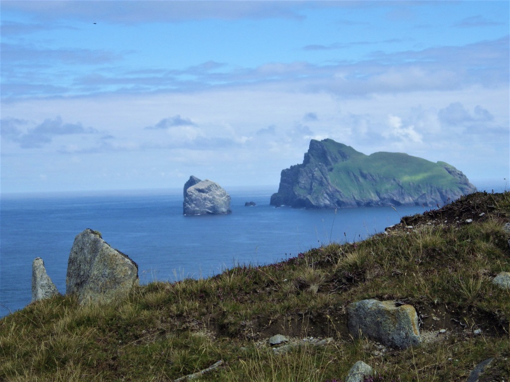
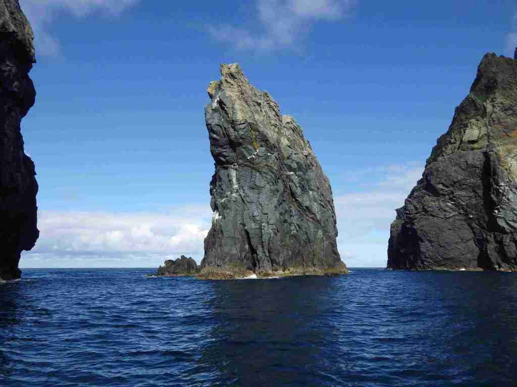
There are three spectacular sea stacks, also the highest in Britain – Stac an Armin, the highest, is 626ft high (191m) and there’s also Stac Lee and Levenish.


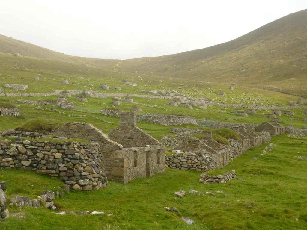
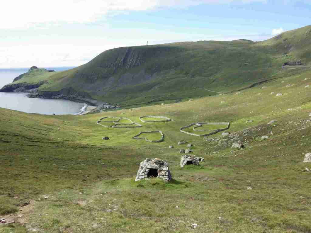
When you arrive at St. Kilda you are ferried ashore to the pier at Village Bay on Hirta. This is where the St. Kildans lived and their abandoned cottages stretch out in a long line round the bay.
Village Street
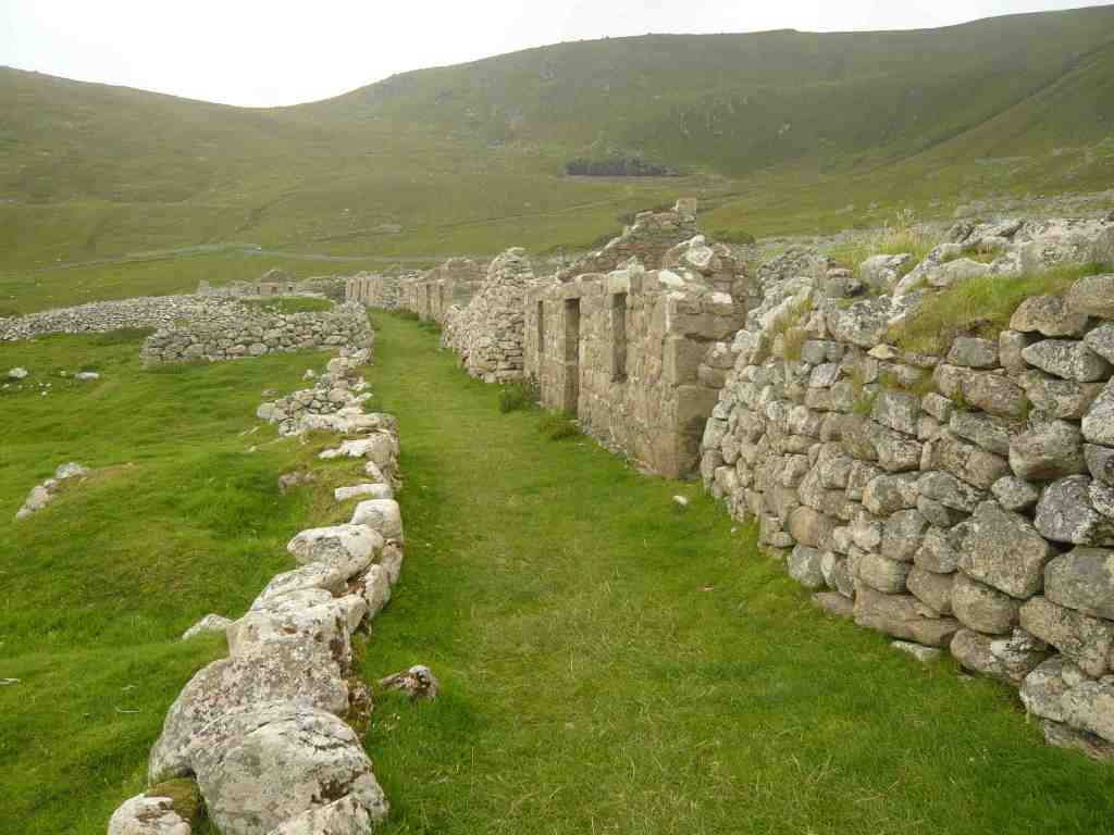
People had lived here for at least 2000 years and there is some evidence of human activity going back much further than that.
It was an exceptionally hard life and St Kildans faced many dangers from disease, starvation and accidents on the treacherous seas and on the vertical cliffs which they descended in order to capture seabirds. By 1930 the population had dwindled to an unsustainable 36 and the last residents were evacuated at their own request.
There are no permanent residents today but there are people working there – civilians who run the radar tracking station for the missile range on South Uist, scientists studying the wildlife, particularly the native Soay sheep, and during the summer season there’s a resident National Trust warden and volunteer work parties.
Some views of Village Street
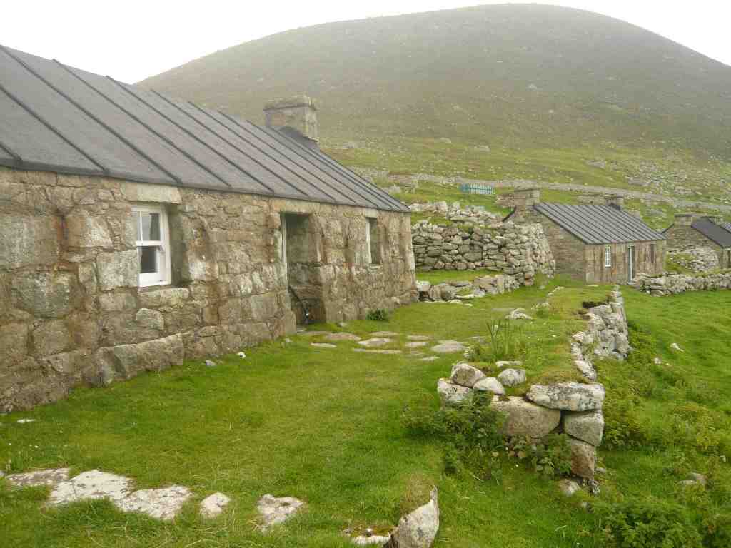


The island is owned and managed by the Nation Trust for Scotland and volunteer work parties have renovated some of the cottages to make accommodation for the seasonal volunteers and researchers who work there. One of the cottages houses a small museum.


Military
In 1957 the island was resettled by the army when it became an outpost of the army rocket range in South Uist. In 1997 the army pulled out and the operation of the radar tracking station was taken over by civilians. They work there on rotation for a few a weeks at a time and a helicopter makes twice weekly visits to ferry personnel between Benbecula Airport and Kilda.
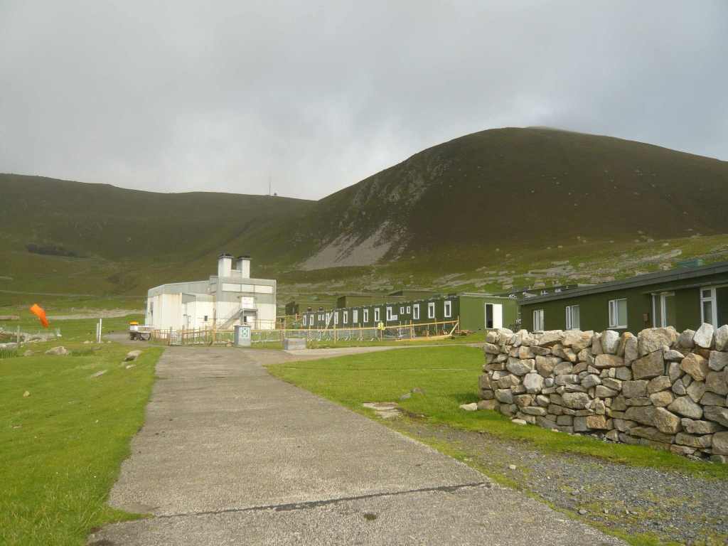
Work has been going on over the last few years to replace the old MOD buildings with buildings that will blend into the environment and be more suited to the harsh weather conditions.

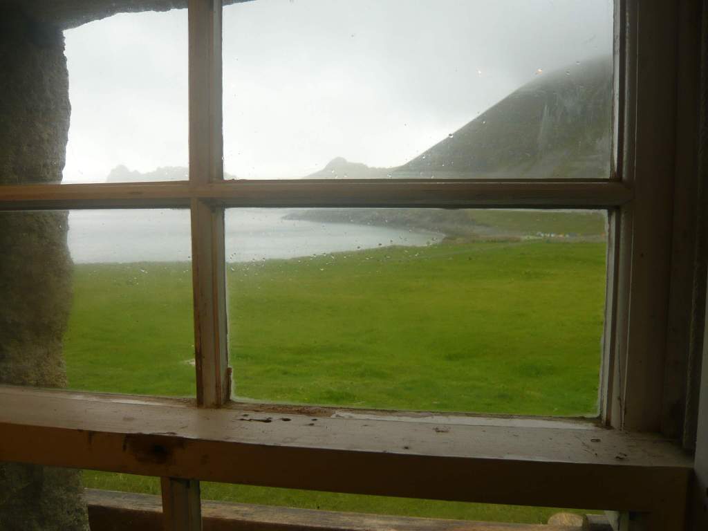
Despite the juxtaposition of old and new, there is still a feeling of being far removed from everyday life and a sense of true remoteness. Once you leave the MOD base and walk along Village Street or wander up the hillsides you are surrounded by history and the visible reminders of how people lived on St Kilda in days gone by.
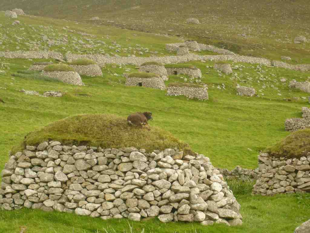
Cleits
All around Village Bay and scattered all over the island, the land is dotted with these stone storage huts called cleits. There are well over 1,000 of them and they were used to store anything from feathers to peats, climbing ropes to meat, fish and produce.

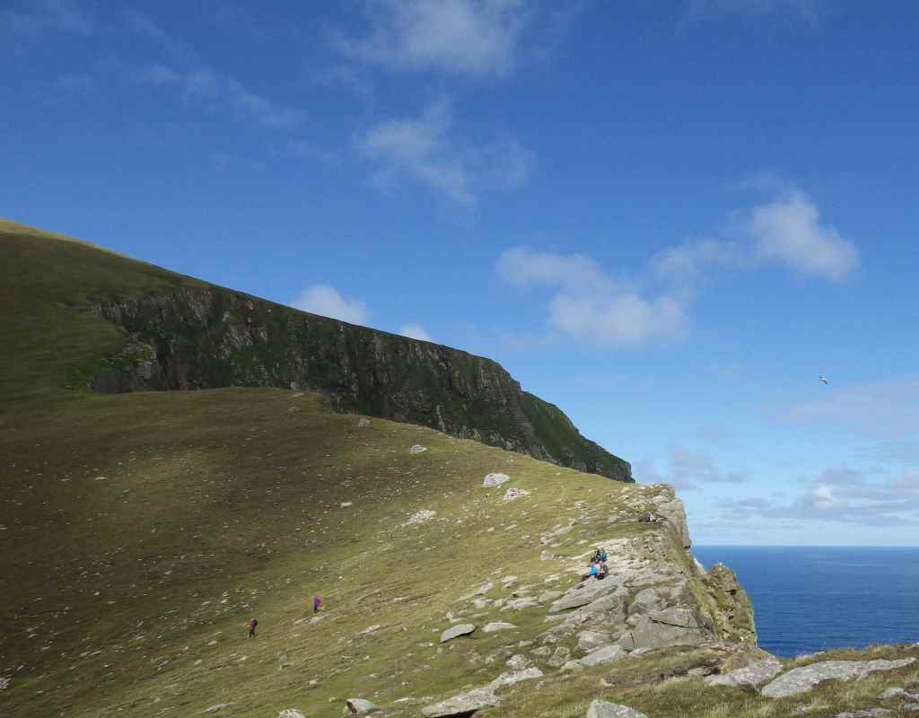
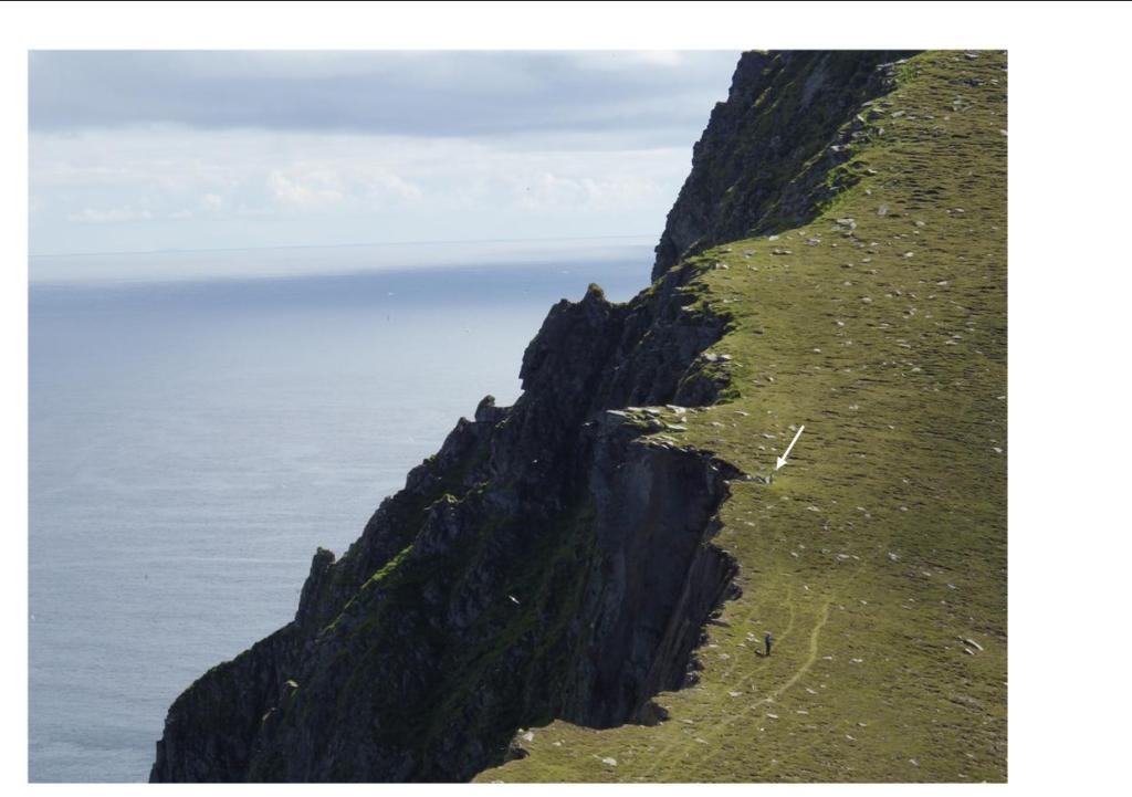
A steep climb up the hill behind Village Street takes you to The Gap, where the land suddenly stops and you find yourself at the edge of 200m high vertical cliffs.

The Gap, where the land suddenly gives way to an almighty drop down to the ocean!

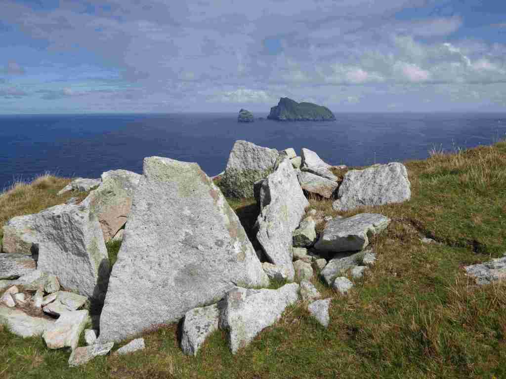
There is nothing so breathtaking as the view of Boreray from The Gap.
Hirta, Dun and Soay sit close together but Boreray is over 5 miles away to the NE.

Archaeology
On the very edge of the cliff sits an intriguing archaeological feature, a boat-shaped stone setting which probably dates from the Bronze Age. Part of it has been lost to the sea due to cliff erosion and when it was excavated archaeologists had to use mountaineering equipment to keep themselves safe. The only finds from the site were some fragments of quartz and two water-worn pebbles. If this was a burial or ritual site, what a setting for someone’s last resting place!

St Kilda must provide endless inspiration for artists. I’m not much of an artist myself but I was inspired to recreate this spectacular view in some way. This was my first attempt at linocut printing and I must admit, I was quite pleased with the result.

~
Back down in the village, Hirta even has a pretty good souterrain! Testament to Iron Age settlement on the island.


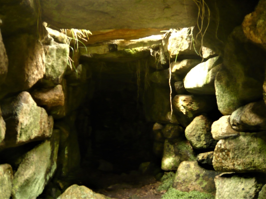
The souterrain is sometimes called Tigh an t-Slithiche, The House of the Fairies, and it was discovered about 1840. It is 25ft long with a small 6ft long side passage on the right hand side. The walls converge towards the roof, which is covered by stone slabs.
~
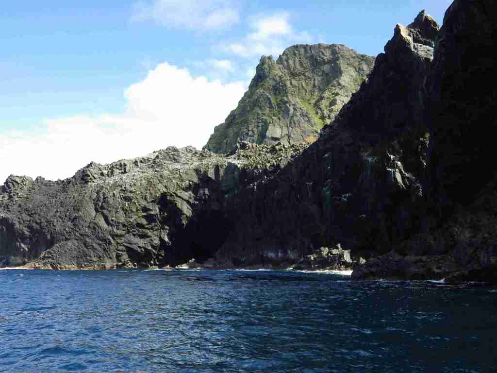
Around the coast of Hirta and Soay
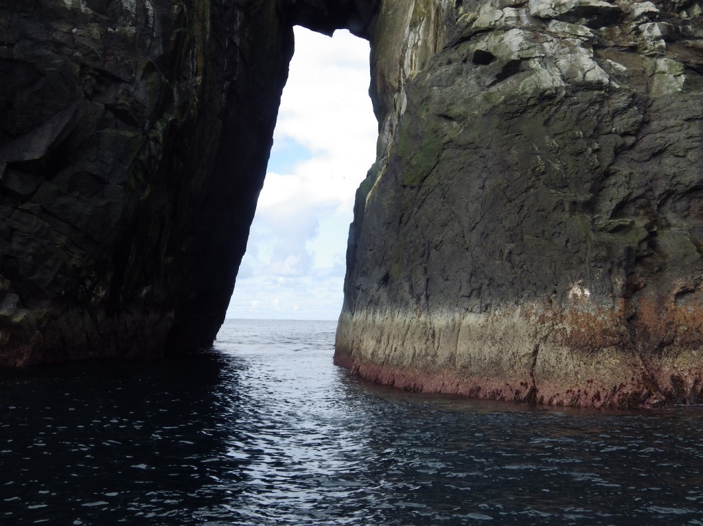

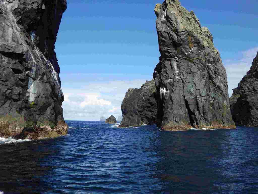
Calm seas meant we were able to go through the narrow channel between Hirta and Soay

St. Kilda is a National Nature Reserve and is Europe’s most important seabird breeding area. It is home to about a million seabirds, including the world’s largest northern gannet colony and large colonies of puffins and fulmars. It is also well known for its bonxies (Great Skuas) who get very territorial during the breeding season and will swoop low over the heads of walkers and even dive bomb them, sometimes making painful contact. It’s recommended to carry a walking stick or pole to wave above your head!
St Kilda is not only a UNESCO World Heritage Site but it is a dual World Heritage Site, because it is recognised for the international importance of both its natural environment and its cultural qualities.
To put this in context, there are only 35 such sites in the world and they include places like Machu Picchu in Peru.
I haven’t written anything about the St. Kildans and their unique way of life because that would make this a much longer post, but more can be found on the National Trust website https://www.nts.org.uk/visit/places/st-kilda?lang=en_gb and there are many books about St Kilda.
Look out for the next post which will be on Boreray!


What a place! Norman Ackroyd, one of my favourite artists, has an etching of St Kilda which captures the wildness of the place. I like your print!
LikeLiked by 1 person
I like Norman Ackroyd too and like his Skelligs etchings. I’m not surprised he’s painted St Kilda as well as the Skelligs because the islands are so alike.
LikeLiked by 1 person
How wonderful! I’d love to go there some day. Your linocut print is fabulous.
LikeLiked by 1 person
I do hope you manage to get there someday. It’s an experience of a lifetime and I don’t know anyone who hasn’t been on a high when they get back from their first visit, or even second! Thank you for the comment on my linocut – I think I need to do some more art!
LikeLike
I hope so too. Some friends went many years ago and it’s always been on our agenda. It’ll be a while yet though, the way things are.
LikeLiked by 1 person
What a special place. You were lucky with the weather. The photos are wonderful but the linocut print is, like the island, special.
LikeLike
It’s a very special place whatever the weather and can be very atmospheric in rain and mist – wait till you see the next photos of Boreray! I enjoyed doing the linocut and it brought back that stunning day when I sat up by the cairn, in a way that a photo can’t.
LikeLike
A place we’ve always wanted to visit. Superb pictures.
LikeLiked by 1 person
I hope you manage to get there sometime. It’s an unforgettable experience!
LikeLiked by 1 person
Thank you.
LikeLiked by 1 person
Looks like a wonderful place
LikeLiked by 1 person